
Satellite-based Earth Observation is a procedure where required information related to Earth’s specific issue is collected using remote sensing. This data is used for numerous applications that later influence our daily lives. The satellite earth observation industry is flourishing day by day because of its countless applications and huge demand. It is more important to understand environmental dynamics because of climate change, food shortages, energy resources, and other similar essential issues in today’s world. This technology helps provide a wide range of characteristics and information related to Earth by observing using different technologies integrated with a satellite system. These observations can be from land, ocean, or air.
This technology has increased humans’ capability to understand Earth and observe physical systems, biological resources, and social institutions. Information gathered from different sources we have learned an enormous amount about the Earth’s behavior. When properly applied, this information can alert us to societal risks, management decisions, and create many opportunities for societal advances. Some of its services include weather forecasts and warnings, assessment of fire risk, flood and drought monitoring and prediction, tsunami propagation modeling and forecasting, natural hazard preparedness and response, public health warnings, disease prevention, and control, and decision support for policymakers in water resources, agriculture, transportation, and other vital economic sectors. These sectors can improve our social and economic well-being.
Earth observation satellites are beneficial for us in many ways; it provides alerts from severe weather conditions and natural hazards. It helps us note the variability in environmental conditions based on which scientists make predictions; these predictions further lead to decisions that directly or indirectly affect us. These decisions can lead to new inventions and new opportunities for advancement. It also extends opportunities for commerce. It provides us with information that has an economic impact on society and the community. The information provided by earth observation satellite technology helps society in different ways like public health and safety, transportation, economic growth, environmental protection, national security, and numerous other economic sectors that depend on this technology. Some of its examples are briefly given below:
Water resources management is also highly dependent on earth observation because it needs to check factors like temperature and humidity continually. This data provides a basis for flood warnings, the water management system’s operation, and water quality protection. According to the predictions, suitable measures are taken to avoid any unpleasant situation.
Earth observation also plays a vital role in national security. Assessment of atmospheric conditions can help the security agencies to work on the military operations according to the ground conditions. This technology also plays a role in keeping an eye on security issues and potential security threats and movements, environmental threats like melting glaciers, etc. Space-based Earth observation technology contributes critically to global security and humanitarian assistance regarding natural hazards around the world and helps promote collaboration.
Health and air quality monitoring use remote sensing technology to predict the problems early before it could lead to any big problem. Timely actions taken can help avoid many environmental health issues and health-related hazards. The use of real-time environmental data can help to improve the predictability of health epidemics. Researchers are working on how different diseases are affected by climate change and how earth observation technology can contribute to this industry.
Earth observation through satellites is also applied to ocean management. Measuring sea surface temperatures, ocean color, sear surface salinity, ocean currents are a few observed and analyzed factors. Satellite provides data to the scientists and planners about these biotic and abiotic conditions. In many countries, commercial fishers rely on satellite data to do fishing efficiently. Earth observation can increase the ability to monitor oceans and minimize any illegal activity like transport or fishing etc. It provides to monitor oceans with high-resolution images and data to aid marine protection without the use of ships. Migration patterns sea species can be observed, and protection measures can be taken accordingly. Ocean management using satellite technology creates efficient communication between all the stakeholders. These approaches allow managers and fishermen to adjust their practices according to changing conditions rapidly.
Now let’s focus on three hot areas that will benefit from Earth observation satellites.
Agricultural Sector
The agricultural sector relies on earth observation to monitor crop production and check environmental conditions like floods, drought, or protection against pests. The information provided about the weather and climate changes can also influence crop production. The energy sector also depends on Earth observation satellite system, particularly weather and climate information. Predictions about summer heat and winter cold help predict many upcoming situations, which will help avoid shortages and plan according to user demands.
Renewable energy resources like wind, solar, hydro and marine, etc., are especially dependent on earth observation systems because they are directly related to atmospheric conditions. It also helps identify and mitigate problems like air pollution and climate change. Food shortages are a severe issue in undeveloped countries where farming is the primary income source and economic development. Appropriate use of natural resources can help overcome these problems. Shortage of food can lead to high food prices and can cause huge problems for a large population. Earth observation technology can help monitor the farming and help the farmers prepare in advance for any unfavorable condition.
Advanced technologies of Artificial intelligence, computer vision, and data analytics are used to establish better agricultural activities. Companies are adopting these methods to increase the speed, quality, and variety of products and services available to farmers. Applications of earth observation in agriculture include:
- Real-time updates on current field, soil, and crop conditions,
- Real-time decision support (e.g., when to irrigate),
- Precision profit mapping,
- Disease and pest identification,
- Immediate alerts to canopy conditional change (e.g., water stress),
- Harvest forecasting,
- Hyper-localized weather,
- Fleet management and performance tracking,
- Animal tracking and monitoring,
- Enhanced field planning – e.g., field profiling and variety selection,
- Visualization and augmented reality to enable direct in-field assessment of live operational and historical issues,
- Risk management system for insurance purposes,
- Precision agriculture and precision livestock,
- Natural hazards protection,
- Soil degradation/soil quality,
- Drought monitoring,
- Irrigation management,
- Landscape protection and land development,
- Biodiversity protection.
There are still many challenges in earth observation data and need more research; for example, to differentiate between crops of similar physical appearance would need developments in computer vision and machine learning. Through utilizing EO data from multiple seasons alongside historical field data sets (e.g., crop records) to generate training data sets, predictions can be made on the likely crop being grown. Through exploiting these developments, new possibilities will be opened up, relating to:
- Chemical inputs to catchment modeling,
- Contamination mitigation,
- Flood risk analysis,
- Support for catchment-sensitive farming,
- Production forecasting,
- In-season input sales,
- Multi-scale disease/pest and weed profiling.
Economic Benefits
Farmers need further optimization of their irrigation management and need services to help them achieve their targets. Farmers would like to know the status of the crops on the field without visiting every plot; knowing the water needs for irrigation and weather forecasts can significantly improve their growth. The amount of energy and water used in irrigation directly impacts farmers’ savings, and if proper and timely information is provided to them, it will bring them many benefits. Informing about any attack by pests or insects can also lead to saving them from huge economic loss. Farmers will be willing to pay for such services, which can measure the required parameters for them.
People involved in agricultural business are key beneficiaries of these services and would purchase any service to benefit their business. Another example is where grower federations or advisory services pay for the solution on behalf of a large number of growers and then add value themselves to the information before sharing the crop intelligence with the growers. Governments can also be a possible source of funding in this sector because governments need solutions to help in food production planning and improve the agricultural sector to improve the country’s economy.
Different irrigation management strategies are possible. For example, one may use satellite-based technologies for the management of water-intensive crops. In that case, irrigation is optimized so that the crops produce at their maximum potential. A different irrigation strategy is to seek a compromise between the cost of irrigation and loss of production. In this case, farmers irrigate their crops at the water stress conditions limit to reduce costs and limit yield loss. This irrigation technique is adopted to optimize economic and technical resources, which are often limited.
Conclusions
By adopting the irrigation practices involving earth observation satellites, data can fulfill the user needs. Research in satellite-based irrigation advisory can lead to timely, cost-efficient, and more informed decisions. Farmers are interested in reducing operating constraints and costs, maximize or stabilize yield and, at the same time, maintain sustainability and environmental efficiency. A continuous effort is still necessary to demonstrate these technologies and in different agricultural environments. These technologies to monitor agricultural systems has many attractive features and can be used for multiple applications. There are a clear role and opportunity for earth observation satellites to contribute to the agricultural industry.
Disaster Preparedness
Disaster preparedness is also highly dependable on space-based earth observation to warn the governments and public about extreme events like storms, droughts, hurricanes, tornados, floods, heatwaves, Tsunamis, volcanic eruptions, and other similar catastrophes or natural disasters. Earth observation technologies provide critical information to deal with these issues, and because of this information safety, measures are taken to protect life, properties, and environmental resources. This technology supports the surveillance and response management by the helping agencies, and they prepare themselves with the preventive measure and strategic deployment on time.
Natural disasters are of increasing frequency and severity in the modern world. Impacts of disaster events on human lives and the economy are increasing every year due to growing urbanization and an increase in the number and severity of extreme weather events. Worldwide economic losses due to disasters are in hundreds of billions of dollars. Development patterns increase the exposure and vulnerability of people and property, and hazards are becoming more frequent due to climate change. The world’s population has never been exposed to such a high level of disaster risk, which is likely to grow in the coming years as the same trends continue.
Economic Benefits
Earth observation satellites can contribute to the development of many services for emergency services. To save the world from large disasters, governments can support this industry by investing in more advanced technology to predict such events. Therefore, the government and disaster management authorities can be the biggest customers of these services. The services industries can also benefit from it, as forecast and prediction of any natural calamity can help these industries to prepare in advance. The beneficiaries of EO in disaster preparedness can be the people, government, and private insurance industry.
Conclusion
Earth observation data can help in disaster mitigation through future scenario prediction, detection of vulnerable areas, and identifying safe alternate routes and other protective measures. These EO data can help in faster recovery after disasters. Investment in making use of space technology is worth it. The improvement in instrumentation and real-time prediction will reduce disaster damages, better prediction, accurate and timely damage estimation, and improved decision making in planning stages. Using EO data and applied techniques, many hazard analysis steps can be performed in a contactless and efficient manner.
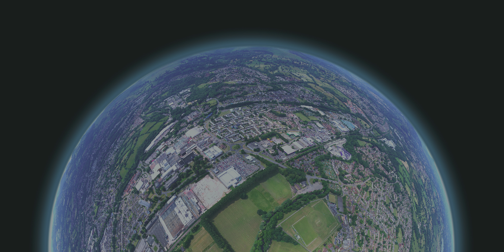
Urban Planning and Management
Earth observation helps urban planning and monitoring, such as measuring population, quality-of-life studies, analysis of land use cover change, building analysis, transportation studies, monitoring growth, and urban sprawl. With the help of EO data, much useful information can be extracted and analyzed, which will help in many planning issues. For example, in Sri Lanka, the city of Kandy, with the support of the World Bank, developed various land use maps to take stock of its current land consumption and land use activities using EO at a fraction of the cost and time taken by traditional survey methods. Another example can be monitoring the overall growth and direction of the sprawl of its built-up areas. Information on land-use change and spatial growth rates and direction can inform city leaders on areas that require administrative attention. For example, to regulate the construction and avoid encroachments on public land, channel resources to create supporting infrastructure, estimate the demand for services, and conserve ecologically sensitive areas. Urban planners and environmental scientists can use EO data to make policies about mitigation measures and develop predictive models for future urban development.
Economic Benefits
Earth observation data can be useful in urban planning and monitoring, which can lead to economic development. Urban spatial planning is a crucial tool in attaining the economic development of a city. Spatial urban planning proceeds beyond description to explain and include regional and local economic development models, urban land and housing market, etc. Urban spatial planning facilitates local economic development that needs to be institutionalized in coordination with representatives of stakeholders and business sectors’ involvement. Spatial urban planning and management is a dominant strategy for local economic development. EO data in urban areas could also be in the interest of private players, especially those operating in the digital economy. Enterprises such as Uber, Amazon, or Google could benefit significantly from better knowing urban fabric by improving their services and targeting their audiences. In an increasingly data-driven economy, it is natural that municipalities keep up-to-date by interacting with databases in terms of cooperation or competition.
Conclusion
Earth observation for urban planning has gained significant attention recently. There is a need for close collaboration between academic researchers and urban planners to adopt these EO data-based technologies. This is particularly important in the developing world, where high population growth and urbanization rates will increasingly pressure urban and regional planners and local authorities to provide essential services while ensuring environmental sustainability. The local government capacity to use remotely sensed data and geographical information system (GIS) software would need to be developed over the next decade to fully utilize the opportunities EO offers to cities with the ability to contextualize analyses to local needs. Satellite imagery usage is nearly endless; it can help monitor everything happening on the Earth’s surface and atmosphere. From deforestation to snowfall, environmental conditions can be monitored, which directly or indirectly have a high impact on the economy and society.
In Closing
Geospatial technologies, remote sensing, satellite communication, and navigation systems provide many new ways for effective management of natural resources. This has resulted in enabling various data and information products for societal benefits and helping planners and decision-makers embark upon unique people-centric services.
There can be no doubt that space-based earth observation and satellite remote sensing is likely to continue to grow as an operational tool for mapping, monitoring, and managing the Earth, as a profit-making entity and as a primary data source for Earth-system science. Global issues such as climate change and its effects will continue to provide enough justification to invest more in this sector.
The potential for real-time imagery has just begun to be realized, and personalized imagery beamed to handheld devices will soon show users their positions in traffic or current weather at their destinations. To speculate further, the online availability of such imagery could facilitate a real-time or “live” Google Earth.
Such a resource potentially enables revolutionary studies involving the global tracking of terrestrial and oceanic life, which could help create, for instance, real-time disease epidemic models, dynamic traffic control, and reactive conservation — but it also raises significant security and privacy concerns.